Some of the current appropriate instruments include WorldView (a commercial venture), Advanced Space- borne Thermal Emission and Reflection Radiometer (ASTER), and Sentinel (European Space Agency).
ASTER, a pioneer in the use of hyperspectral imagery, was launched in 1999 as one of five instruments on NASA’s Terra spaceborne platform. It captures high-resolution (15-90 square meters per pixel) images of the Earth in 14 different wavelengths of the electro- magnetic spectrum, from visible to thermal infrared light (VNIR, SWIR and TIR). Designed as a geological mapping instrument, it has been widely adopted by government geological survey organisations and science agencies (including Geoscience Australia and CSIRO) as a remote sensing tool and pre-competitive datasets to help reduce exploration risk.,
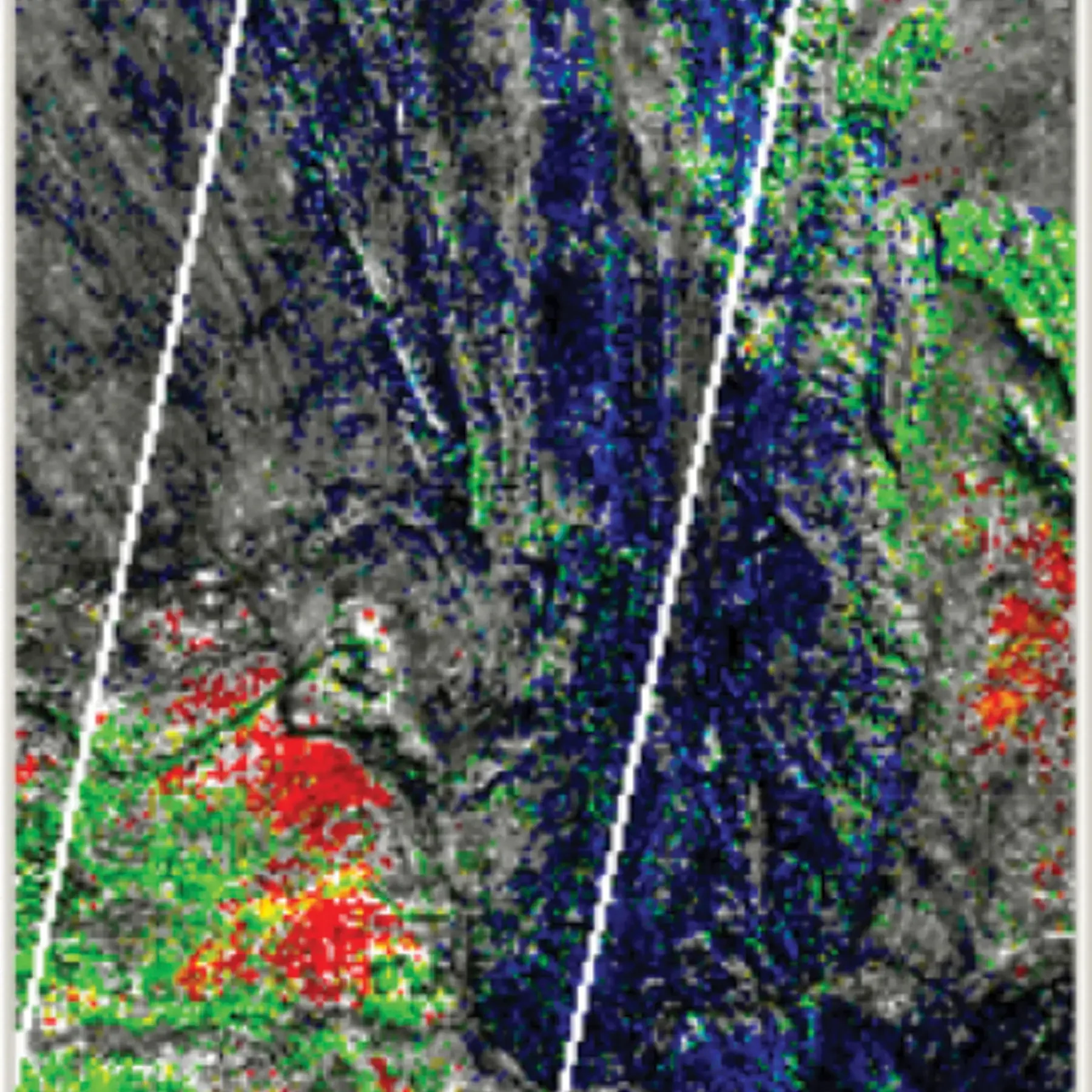
ASTER provides information that corresponds to the absorption features of minerals, in particular, alteration minerals (i.e. minerals known to surround target mineral deposits like copper porphyries) as shown in Figure 20. The effectiveness of ASTER to map minerals was tested in the Mount Isa region as part of a study that involved ground truthing ASTER-derived mineral maps with a portable short-wavelength infrared mineral analyser (PIMA) capable of identifying many of the same mineral species.
The benefits of satellite-based sensors delivering hyperspectral data are that data collection is rapid, and there is no on-ground impact from data collection. The surveys help explorers evaluate large areas of ground for potential to host mineral deposit styles of interest. The hyperspectral data complements satellite imagery, aerial photography, magnetics, radiometrics and gravity surveys. The resulting mineral, chemistry, vegetation and surface texture maps are used to identify areas of alteration and enable mineral emplacement models to be tested.
The real potential for ASTER mineral index maps as an exploration tool lies in their identification of mineral distribution associated with alteration haloes and fluid flow. Large ore deposits lie on chemical gradients such as changes in redox, pH, temperature, and pressure. ASTER can identify chemical gradients preserved in the rock record as subtle variations in mineralogy. Many world-class gold and copper deposits have large, previously unrecognised, white mica haloes. Deposit location corresponds to changes in white mica composition from muscovite to phengite . The variation in composition appears to reflect chemical changes in ore fluid chemistry, resulting in metal precipitation.
Earth observations, including those gleaned from ASTER data, have aided exploration. Kentor Gold Limited (KCL), for example, identified several unknown and unexplored copper-gold zones at the Jervois Copper-Silver-Gold Project in the Northern Territory.
Figure 20 - An example of ASTER mineral index maps from the Bull Creek area of Mt Isa shows phengite, muscovite and alunite RGB thresholded to highlight likely occurrence


